

Scott Islands Protected Marine Area Establishment Order (SI/2018-44)
Full Document:
- HTMLFull Document: Scott Islands Protected Marine Area Establishment Order (Accessibility Buttons available) |
- XMLFull Document: Scott Islands Protected Marine Area Establishment Order [9 KB] |
- PDFFull Document: Scott Islands Protected Marine Area Establishment Order [1242 KB]
Regulations are current to 2024-05-01
SCHEDULE 2 / ANNEXE 2(Section 1 / article 1)Map of the Scott Islands Protected Marine Area / Carte de la zone marine protégée des îles Scott
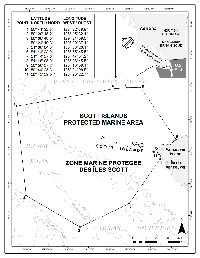
In this schedule, the lines connecting the points are rhumb lines. / Dans la présente annexe, les points sont reliés entre eux par des loxodromies.
- Date modified: